Korea Cross-Country Route: Section Data & Free GPX
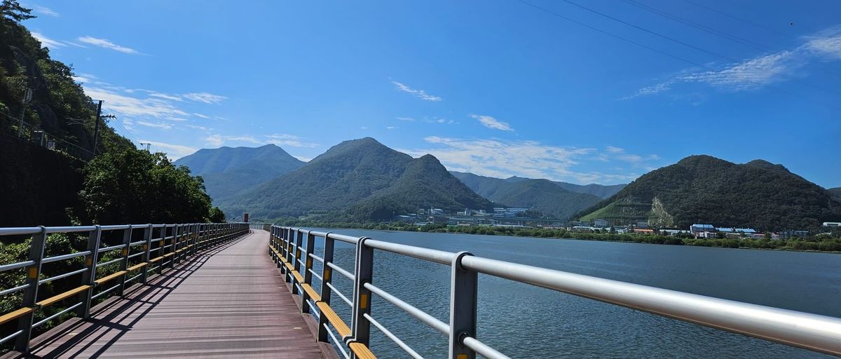
The cross-country bicycle route (국토종주) runs about 600 km from the west coast at Incheon to Busan on the south coast, almost entirely on dedicated bike paths. This page is our working reference for the route: measured distances, certification centers, and GPX files you can load onto your bike computer.
Everything here is free. We keep this page updated as the official route data changes — the date on each table tells you when it was last rebuilt.
How the route works
The route is made of five sections that connect end to end. At certification centers along the way (small red phone booths), you stamp a passport that you can buy at Incheon or at bike shops along the route. Complete all the stamps and you can register the ride and receive a medal at the finish.
You don't need the passport to ride — the path is public — but most riders find the stamps become half the fun.
Cross-Country Route — Sections
Incheon to Busan on the certification route. Typical schedule: 5-7 riding days.
Nakdonggang distance is the full route from Andong; cross-country riders join it at Sangju Sangpung Bridge (301 km to Busan). Updated 2026-07-18.
GPX files
One file per section. Each file contains the track plus the certification centers as waypoints. Two honest notes:
- The tracks are built from the government route database (MOIS, data.go.kr), not hand-drawn. On the Ara and Seoul sections the database has a few short breaks (1.5-2.6 km); they appear as track breaks rather than invented lines. We are verifying these on the ground and will update the files.
- The tracks carry no elevation data. Your bike computer or app will fill elevation from its own maps.
Section 1 — Ara Bikeway (21 km, Easy)
Ara West Sea Lock (Incheon) → Ara Hangang Lock. A flat canal-side path and the ceremonial start of the ride: the west-coast start stamp is here. Riding time is under two hours, so most riders combine it with the Seoul section on day one.
Ara Bikeway — Certification Centers
Ara West Sea Lock (Incheon) → Ara Hangang Lock · 21 km · Easy
Distances measured from official route data (MOIS, data.go.kr). Signage on the ground may differ slightly. Updated 2026-07-18.
Section 2 — Hangang Route, Seoul (56 km, Easy)
Ara Hangang Lock → Paldang Bridge, following the Han River through Seoul. Flat and fully paved. It is the busiest stretch of the whole route — expect other riders, walkers, and full convenience stores rather than solitude. Good coffee and food options the entire way.
Hangang Route (Seoul) — Certification Centers
Ara Hangang Lock → Paldang Bridge · 56 km · Easy
Distances measured from official route data (MOIS, data.go.kr). Signage on the ground may differ slightly. Updated 2026-07-18.
Section 3 — Namhangang Route (131 km, Easy-Moderate)
Paldang Bridge → Chungju. Much of it follows a converted railway line along the South Han River, with old stations and tunnels. Mostly flat with a few short hills. Cross-country riders turn off toward Chungju Tangeumdae around km 119; the final stretch to Chungju Dam completes the separate Namhangang certification if you want it.
Namhangang Route — Certification Centers
Paldang Bridge → Chungju Dam · 131 km · Easy-Moderate
Distances measured from official route data (MOIS, data.go.kr). Signage on the ground may differ slightly. Updated 2026-07-18.
Section 4 — Saejae Route (100 km, Challenging)
Chungju Tangeumdae → Sangju Sangpung Bridge. The mountain stage: two real passes, Sojo-ryeong and Ihwaryeong (about 530 m). The climbs are steady rather than brutal, but with luggage they earn respect. What goes up comes down — the descent toward Mungyeong is long and fast.
Saejae Route — Certification Centers
Chungju Tangeumdae → Sangju Sangpung Bridge · 99 km · Challenging
Distances measured from official route data (MOIS, data.go.kr). Signage on the ground may differ slightly. Updated 2026-07-18.
Section 5 — Nakdonggang Route (366 km full / 301 km from Sangju, Moderate)
The long haul south along the Nakdong River to Busan. The full route starts at Andong; cross-country riders join it at Sangju Sangpung Bridge, which leaves 301 km to the estuary. Mostly flat riverside riding, but the section south of Hapcheon has a handful of short, steep climbs that surprise tired legs. Plan resupply ahead here — services are thinner than in the northern half.
Nakdonggang Route — Certification Centers
Andong Dam area → Nakdonggang Estuary Bank (Busan) · 366 km · Moderate (long)
Distances measured from official route data (MOIS, data.go.kr). Signage on the ground may differ slightly. Updated 2026-07-18.
Data source and updates
Route and facility data: Ministry of the Interior and Safety bike path database (data.go.kr), open for any use. Distance measurement and packaging by Platoon Cycles. Signage on the ground may differ slightly from measured figures.
Last data build: 2026-07-18. If you find a spot where the track and the real path disagree, tell us — that is exactly the kind of correction this page exists for.